Open-Source Fire Science
Open-Source Fire Science
Coen, J. L., E. N. Stavros, and J. A. Fites-Kaufman, 2018: Deconstructing the King megafire. Ecological Applications. doi:10.1002/eap.1752.
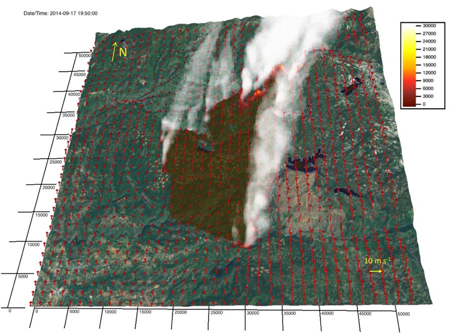
The King Fire was ignited at 6:37 PM on Sept. 13, 2014, spread during a severe drought in the central Sierra Nevada mountain range in complex terrain covered by mixed conifer forests, which generates complex fuel beds shaped by drought, land management practices (e.g. forest cultivation and harvesting, fire suppression, and fuel mitigation), and burn scars from previous fires. The King fire grew 7 km to the northeast through the evening of Sept. 16 as nearby surface weather stations recorded weak to moderate south-south-westerly winds upon which weak diurnal circulations and gusts of 2-10 m s-1 were superimposed.
From 9:49 PM Sept. 16, when the fire was mapped by the National Infrared Operations (NIROPs) airborne imager, until 1:06 PM Sept. 17, when satellite active fire detection data detected the fire entering the Rubicon Canyon, the fire traveled north over rolling hills. In an afternoon run that was unanticipated in light of weak to moderate ambient winds, the fire grew over 16,200 ha (40,000 acres), racing approximately 25 km to the northeast over the next 11 h � an average spread rate of 2.3 km h-1 � following the canyon to its crest at Hell Hole Reservoir, where growth stalled.